
Carte topographique Kotdwar
Carte interactive
Cliquez sur la carte pour afficher l’altitude.
À propos de cette carte
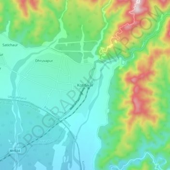
Nom : Carte topographique Kotdwar, altitude, relief.
Altitude moyenne : 471 m
Altitude minimum : 324 m
Altitude maximum : 910 m
Kotdwar lies on the western margin of the Himalayas, at an altitude of 454 m (1,490 ft) above sea level.