Carte topographique Lac Doolittle
Carte interactive
Cliquez sur la carte pour afficher l’altitude.
À propos de cette carte
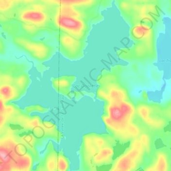
Autres cartes topographiques
Cliquez sur une carte pour visualiser sa topographie, son altitude et son relief.
![Carte topographique Lac Michel, altitude, relief](/pub/maps/way/ds4s/cbjcccz/icon.jpg)
Lac Michel
Canada > Québec > La Vallée-de-la-Gatineau > Lac-Pythonga
Lac Michel, Lac-Pythonga, La Vallée-de-la-Gatineau, Outaouais, Québec, Canada
Altitude moyenne : 364 m
![Carte topographique Lac Rhéaume, altitude, relief](/pub/maps/way/db9m/8mzmcmt/icon.jpg)
Lac Rhéaume
Canada > Québec > La Vallée-de-la-Gatineau > Lac-Pythonga
Lac Rhéaume, Lac-Pythonga, La Vallée-de-la-Gatineau, Outaouais, Québec, Canada
Altitude moyenne : 296 m
![Carte topographique Lac Camatose, altitude, relief](/pub/maps/relation/2vrr/dm45tp/icon.jpg)
Lac Camatose
Canada > Québec > La Vallée-de-la-Gatineau > Lac-Pythonga
Lac Camatose, Lac-Pythonga, La Vallée-de-la-Gatineau, Outaouais, Québec, Canada
Altitude moyenne : 365 m
![Carte topographique Lac Jean Pere, altitude, relief](/pub/maps/relation/7cs8/6mb14/icon.jpg)
Lac Jean Pere
Canada > Québec > La Vallée-de-la-Gatineau > Lac-Pythonga
Lac Jean Pere, Lac-Pythonga, La Vallée-de-la-Gatineau, Outaouais, Québec, Canada
Altitude moyenne : 386 m
![Carte topographique Ruisseau Antostagan, altitude, relief](/pub/maps/way/5x5k/3ph9k18/icon.jpg)
Ruisseau Antostagan
Canada > Québec > La Vallée-de-la-Gatineau > Lac-Pythonga
Ruisseau Antostagan, Lac-Pythonga, La Vallée-de-la-Gatineau, Outaouais, Québec, Canada
Altitude moyenne : 395 m
![Carte topographique Lac Camatose, altitude, relief](/pub/maps/node/kr18/889khhz4/icon.jpg)
Lac Camatose
Canada > Québec > La Vallée-de-la-Gatineau > Lac-Pythonga
Lac Camatose, Lac-Pythonga, La Vallée-de-la-Gatineau, Outaouais, Québec, Canada
Altitude moyenne : 362 m