
Carte topographique Flagstaff
Carte interactive
Cliquez sur la carte pour afficher l’altitude.
À propos de cette carte
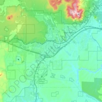
Nom : Carte topographique Flagstaff, altitude, relief.
Altitude moyenne : 2 176 m
Altitude minimum : 2 008 m
Altitude maximum : 2 830 m
In 1894, Massachusetts astronomer Percival Lowell hired A. E. Douglass to scout an ideal site for a new observatory. Douglass, impressed by Flagstaff's elevation, named it as an ideal location for the now famous Lowell Observatory, saying: "other things being equal, the higher we can get the better". Two years later, the specially designed 24-inch (610 mm) Clark telescope that Lowell had ordered was installed. In 1930, Pluto was discovered using one of the observatory's telescopes. In 1955 the U.S. Naval Observatory joined the growing astronomical presence, and established the United States Naval Observatory Flagstaff Station, where Pluto's satellite, Charon, was discovered in 1978.