Carte topographique Mahad
Cliquez sur la carte pour afficher l’altitude.
Mahad
Several disasters like floods and landslides have continuously devastated markets and old houses, specifically classic Konkani-styled architecture, causing great loss of life. This is primarily due to lower elevation of the city compared to surrounding areas and being surrounded by rivers on all sides, making the city like a triangular island. Also, Konkan, receives predominantly very heavy rainfall in comparison to rest of Maharashtra.
À propos de cette carte
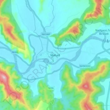
Nom : Carte topographique Mahad, altitude, relief.
Lieu : Mahad, Mahad Taluka, Raigad, Maharashtra, 402300, India (18.04075 73.38438 18.12075 73.46438)
Altitude moyenne : 75 m
Altitude minimum : 0 m
Altitude maximum : 366 m
Autres cartes topographiques
Cliquez sur une carte pour visualiser sa topographie, son altitude et son relief.