
Carte topographique Shangqiu
Carte interactive
Cliquez sur la carte pour afficher l’altitude.
À propos de cette carte
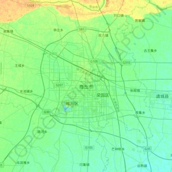
Nom : Carte topographique Shangqiu, altitude, relief.
Lieu : Shangqiu, Liangyuan District, Shangqiu City, Henan, China (34.25710 115.49086 34.57710 115.81086)
Altitude moyenne : 51 m
Altitude minimum : 44 m
Altitude maximum : 67 m
Shangqiu is the easternmost prefecture of Henan province. Its administrative area ranges in longitude from 114 °49′ E to 116° 39′ E and in latitude from 33° 43′ N to 34° 52′ N, covering 10,704 square kilometres (4,133 sq mi). The city lies on the North China Plain and is mostly flat, with elevations ranging from 30 to 70 metres (98 to 230 ft), though the northwest part of the prefecture is more elevated than the southeast.
Autres cartes topographiques
Cliquez sur une carte pour visualiser sa topographie, son altitude et son relief.
Suiyang District
Suiyang District, Shangqiu, Henan, China
Altitude moyenne : 48 m