
Carte topographique Municipal District of Greenview
Carte interactive
Cliquez sur la carte pour afficher l’altitude.
À propos de cette carte
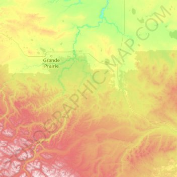
Nom : Carte topographique Municipal District of Greenview, altitude, relief.
Lieu : Municipal District of Greenview, Alberta, Canada (53.80181 -120.00137 55.68101 -115.96744)
Altitude moyenne : 927 m
Altitude minimum : 371 m
Altitude maximum : 2 602 m
Autres cartes topographiques
Cliquez sur une carte pour visualiser sa topographie, son altitude et son relief.
Hamlet of Grande Cache
Canada > Alberta > Municipal District of Greenview
Hamlet of Grande Cache, Municipal District of Greenview, Alberta, T0E 0Y0, Canada
Altitude moyenne : 1 154 m