
Carte topographique Ore Lake
Carte interactive
Cliquez sur la carte pour afficher l’altitude.
À propos de cette carte
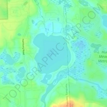
Nom : Carte topographique Ore Lake, altitude, relief.
Altitude moyenne : 268 m
Altitude minimum : 257 m
Altitude maximum : 295 m
Autres cartes topographiques
Cliquez sur une carte pour visualiser sa topographie, son altitude et son relief.
Hamburg
United States > Michigan > Livingston County > Hamburg Township
Hamburg, Hamburg Township, Livingston County, Michigan, 48139, United States
Altitude moyenne : 277 m
Lakeland
United States > Michigan > Livingston County > Hamburg Township
Lakeland, Hamburg Township, Livingston County, Michigan, 48143, United States
Altitude moyenne : 267 m
Hamburg Lake
United States > Michigan > Livingston County > Hamburg Township
Hamburg Lake, Hamburg Township, Livingston County, Michigan, United States
Altitude moyenne : 276 m