

Carte topographique Friday Lake
Cliquez sur la carte pour afficher l’altitude.
À propos de cette carte

Nom : Carte topographique Friday Lake, altitude, relief.
Altitude moyenne : 24 m
Altitude minimum : 15 m
Altitude maximum : 84 m
Autres cartes topographiques
Cliquez sur une carte pour visualiser sa topographie, son altitude et son relief.
Connaught Water
United Kingdom > England > Essex > Epping Forest > Sewardstonebury
Altitude moyenne : 57 m

Nazeing Gate
United Kingdom > England > Essex > Epping Forest > Bumble's Green > Nazeing
Altitude moyenne : 70 m
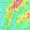
Epping Forest
United Kingdom > England > Essex > Epping Forest > Debden Green
It lies on a ridge between the valleys of the rivers Lea and Roding. It contains areas of woodland, grassland, heath, streams, bogs and ponds, and its elevation and thin gravelly soil (the result of glaciation) historically made it less suitable for agriculture. The Forest was historically managed as a common;…
Altitude moyenne : 44 m
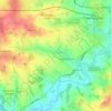
Stanford Rivers
United Kingdom > England > Essex > Epping Forest > Stanford Rivers
Altitude moyenne : 65 m
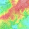
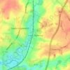

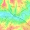
Passingford Bridge
United Kingdom > England > Essex > Epping Forest > Stapleford Tawney
Altitude moyenne : 53 m


How Green
United Kingdom > England > Essex > Epping Forest > Stapleford Abbotts
Altitude moyenne : 63 m
Thornwood Common
United Kingdom > England > Essex > Epping Forest > Thornwood Common
Altitude moyenne : 89 m
Steward's Green
United Kingdom > England > Essex > Epping Forest > Coopersale Street > Steward's Green
Altitude moyenne : 76 m
Epping Forest
United Kingdom > England > Essex > Epping Forest > Debden Green
It lies on a ridge between the valleys of the rivers Lea and Roding. It contains areas of woodland, grassland, heath, streams, bogs, and ponds, and its elevation and thin gravelly soil (the result of glaciation) historically made it less suitable for agriculture. The forest was historically managed as a…
Altitude moyenne : 44 m
Epping Forest
United Kingdom > England > Essex > Epping Forest > Debden Green
It lies on a ridge between the valleys of the rivers Lea and Roding. It contains areas of woodland, grassland, heath, streams, bogs, and ponds, and its elevation and thin gravelly soil (the result of glaciation) historically made it less suitable for agriculture. The forest was historically managed as a…
Altitude moyenne : 44 m

Epping Forest
United Kingdom > England > Essex > Epping Forest
It lies on a ridge between the valleys of the rivers Lea and Roding. It contains areas of woodland, grassland, heath, streams, bogs, and ponds, and its elevation and thin gravelly soil (the result of glaciation) historically made it less suitable for agriculture. The forest was historically managed as a…
Altitude moyenne : 44 m