
Carte topographique Somers
Carte interactive
Cliquez sur la carte pour afficher l’altitude.
À propos de cette carte
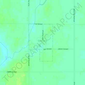
Nom : Carte topographique Somers, altitude, relief.
Lieu : Somers, Calhoun County, Iowa, United States (42.37198 -94.43635 42.38392 -94.42605)
Altitude moyenne : 352 m
Altitude minimum : 346 m
Altitude maximum : 357 m
Autres cartes topographiques
Cliquez sur une carte pour visualiser sa topographie, son altitude et son relief.
Rands
United States > Iowa > Calhoun County
Rands, Calhoun County, Iowa, United States
Altitude moyenne : 358 m
Lake City
United States > Iowa > Calhoun County > Lake City
Lake City, Calhoun County, Iowa, 51449, United States
Altitude moyenne : 367 m
Pomeroy
United States > Iowa > Calhoun County
Pomeroy, Calhoun County, Iowa, 50575, United States
Altitude moyenne : 375 m