
Carte topographique Huamachuco
Carte interactive
Cliquez sur la carte pour afficher l’altitude.
Huamachuco
The hamlets at higher elevations (3900–4000 m.) were bases for their herding of domesticated animals, as agriculture could not survive at those heights. The settlements in the lower elevations (2500–3000 m.) contained large amounts of agricultural tools, showing the importance of crops.
À propos de cette carte
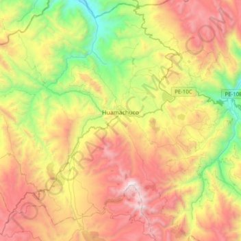
Nom : Carte topographique Huamachuco, altitude, relief.
Lieu : Huamachuco, Province of Sánchez Carrión, La Libertad, Peru (-7.95735 -78.18765 -7.69427 -77.88111)
Altitude moyenne : 3 359 m
Altitude minimum : 2 231 m
Altitude maximum : 4 720 m