
Carte topographique Ishiara
Carte interactive
Cliquez sur la carte pour afficher l’altitude.
À propos de cette carte
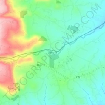
Nom : Carte topographique Ishiara, altitude, relief.
Lieu : Ishiara, Embu, East Kenya, Kenya (-0.47000 37.76330 -0.43000 37.80330)
Altitude moyenne : 874 m
Altitude minimum : 803 m
Altitude maximum : 1 021 m
Autres cartes topographiques
Cliquez sur une carte pour visualiser sa topographie, son altitude et son relief.
Gachoka
Kenya > Embu > Mbeere South
Gachoka, Mbeere South, Embu, Eastern, Kenya
Altitude moyenne : 1 174 m
Kindaruma
Kenya > Embu > Mbeere South
Kindaruma, Mbeere South, Embu, Eastern, Kenya
Altitude moyenne : 782 m
Kanywambora
Kenya > Embu > Mbeere North
Kanywambora, Mbeere North, Embu, East Kenya, Kenya
Altitude moyenne : 1 101 m