
Carte topographique Rysy
Carte interactive
Cliquez sur la carte pour afficher l’altitude.
À propos de cette carte
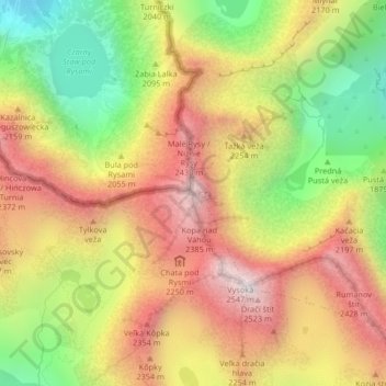
Nom : Carte topographique Rysy, altitude, relief.
Altitude moyenne : 2 005 m
Altitude minimum : 1 423 m
Altitude maximum : 2 528 m
It is possible to reach the peak from the Slovak side, starting at Štrbské pleso and passing Chata pod Rysmi, a mountain chalet at an altitude of 2,250 m (7,380 ft). Between November 1 and June 15, the trail and chalet on the Slovak side are closed.