

Faire un don
Équipez-vous pour votre prochaine aventure :
En tant que Partenaire Amazon, ce site perçoit une commission sur les achats éligibles sans surcoût pour vous.
Carte topographique Bengough
Cliquez sur la carte pour afficher l’altitude.
Faire un don
Équipez-vous pour votre prochaine aventure :
En tant que Partenaire Amazon, ce site perçoit une commission sur les achats éligibles sans surcoût pour vous.
Bengough
Bengough is located within the Missouri Coteau near Willow Bunch Lake, Big Muddy Lake, Salt Lake and Channel Lake. Few well-defined streams or creeks are located near the townsite. The landscape where the town is located is characterized by pitted and rolling topography of the moraine deposits that dominate the landscape. Just south of Bengough is the Big Muddy Badlands.
Faire un don
Équipez-vous pour votre prochaine aventure :
En tant que Partenaire Amazon, ce site perçoit une commission sur les achats éligibles sans surcoût pour vous.
À propos de cette carte
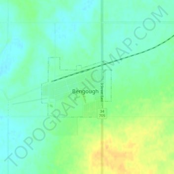
Nom : Carte topographique Bengough, altitude, relief.
Lieu : Bengough, Division No. 2, Saskatchewan, S0C 0K0, Canada (49.39171 -105.13666 49.40099 -105.12006)
Altitude moyenne : 690 m
Altitude minimum : 679 m
Altitude maximum : 708 m
Faire un don
Équipez-vous pour votre prochaine aventure :
En tant que Partenaire Amazon, ce site perçoit une commission sur les achats éligibles sans surcoût pour vous.