
Carte topographique Santa
Carte interactive
Cliquez sur la carte pour afficher l’altitude.
À propos de cette carte
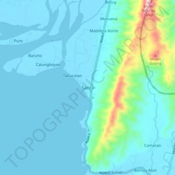
Nom : Carte topographique Santa, altitude, relief.
Lieu : Santa, Ilocos Sur, Ilocos Region, 2703, Philippines (17.44599 120.39454 17.52599 120.47454)
Altitude moyenne : 75 m
Altitude minimum : -1 m
Altitude maximum : 605 m
The topography of the municipality is undulating to rolling with slope ranging from 0-30%.