
Carte topographique Bydgoszcz
Carte interactive
Cliquez sur la carte pour afficher l’altitude.
Bydgoszcz
The etymology of the German name of the town developed later and derives from the river Brahe (Brda in Polish), on whose banks the city is located, and berg, elevation, mount(ain), combined to 'Brahenberg', with 'a' pronounced in East Pomeranian Low German rather like 'å', later contracted to Bromberg, dropping the weak 'h', with the 'n' assimilated as 'm' to the following labial sound 'b'.
À propos de cette carte
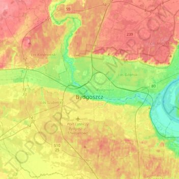
Nom : Carte topographique Bydgoszcz, altitude, relief.
Lieu : Bydgoszcz, Kuyavian-Pomeranian Voivodeship, Poland (53.05011 17.87417 53.20934 18.20259)
Altitude moyenne : 69 m
Altitude minimum : 24 m
Altitude maximum : 109 m
Autres cartes topographiques
Cliquez sur une carte pour visualiser sa topographie, son altitude et son relief.