
Carte topographique Harohalli
Cliquez sur la carte pour afficher l’altitude.
À propos de cette carte
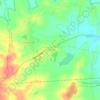
Nom : Carte topographique Harohalli, altitude, relief.
Lieu : Harohalli, Mysuru taluk, Mysuru District, Karnataka, India (12.30050 76.76067 12.34050 76.80067)
Altitude moyenne : 699 m
Altitude minimum : 669 m
Altitude maximum : 740 m
Autres cartes topographiques
Cliquez sur une carte pour visualiser sa topographie, son altitude et son relief.
Mysuru
India > Karnataka > Mysuru taluk > Mysuru
Mysore is situated at the foothills of the Chamundi Hills. At an altitude of 770 m (2,530 ft) above mean sea level, the city of Mysore is geographically located at 12° 18′ 26″ north latitude and 76° 38′ 59″ east longitude. It is about 140 km (87.0 mi) southwest of the state's capital, Bangalore, and…
Altitude moyenne : 752 m