
Carte topographique Florina
Carte interactive
Cliquez sur la carte pour afficher l’altitude.
Florina
Florina is one of the coldest towns in Greece, because of its elevation and geographic position. Heavy snowfalls, thick fog and below-freezing temperatures are common during the winter months, while the summers are mild. Under the Köppen climate classification, Florina has a humid subtropical climate (Cfa) with strong hot-summer continental climate (Dfa) influences.
À propos de cette carte
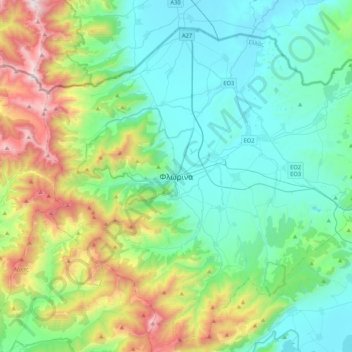
Nom : Carte topographique Florina, altitude, relief.
Altitude moyenne : 999 m
Altitude minimum : 574 m
Altitude maximum : 2 319 m