
Carte topographique Burrough on the Hill
Carte interactive
Cliquez sur la carte pour afficher l’altitude.
À propos de cette carte
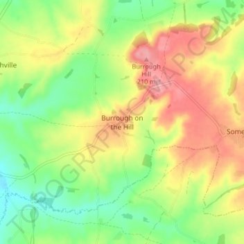
Nom : Carte topographique Burrough on the Hill, altitude, relief.
Altitude moyenne : 153 m
Altitude minimum : 102 m
Altitude maximum : 212 m
Autres cartes topographiques
Cliquez sur une carte pour visualiser sa topographie, son altitude et son relief.
Belvoir Castle
Vereinigtes Königreich > England > Leicestershire > Melton > Belvoir
Altitude moyenne : 82 m