
Carte topographique Dubnica nad Váhom
Carte interactive
Cliquez sur la carte pour afficher l’altitude.
À propos de cette carte
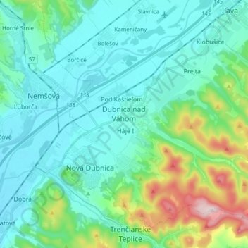
Nom : Carte topographique Dubnica nad Váhom, altitude, relief.
Altitude moyenne : 309 m
Altitude minimum : 215 m
Altitude maximum : 700 m
It is located on the Váh river, in the Ilava Basin, between the White Carpathians and Strážovské vrchy mountains, at an altitude of 242 metres. The town's cadastral area is composed of Dubnica and "city part" Prejta, annexed in 1973.