
Carte topographique Shohola
Carte interactive
Cliquez sur la carte pour afficher l’altitude.
À propos de cette carte
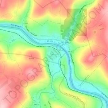
Nom : Carte topographique Shohola, altitude, relief.
Altitude moyenne : 271 m
Altitude minimum : 154 m
Altitude maximum : 391 m
Autres cartes topographiques
Cliquez sur une carte pour visualiser sa topographie, son altitude et son relief.
Walker Lake
United States > Pennsylvania > Pike County > Shohola Township
Walker Lake, Shohola Township, Pike County, Pennsylvania, 18458, United States
Altitude moyenne : 375 m