
Carte topographique Vitosha
Carte interactive
Cliquez sur la carte pour afficher l’altitude.
À propos de cette carte
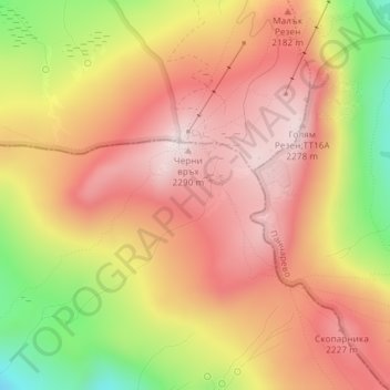
Nom : Carte topographique Vitosha, altitude, relief.
Lieu : Vitosha, Pernik, Bulgaria (42.55995 23.27995 42.56005 23.28005)
Altitude moyenne : 2 105 m
Altitude minimum : 1 820 m
Altitude maximum : 2 282 m
Due to a great variability in elevation, a rich diversity of climates, flora and fauna can be found within the park. Research has revealed that on the comparatively small area of the mountain there are 1,500 species of higher plants, 500 species of fungi, 500 species of algae, 326 species of mosses, and 200 species of lichens. Among the, 31 species are Balkan endemics and 52 species are included in the IUCN Red List of endangered species.
Autres cartes topographiques
Cliquez sur une carte pour visualiser sa topographie, son altitude et son relief.