
Carte topographique Jingdezhen
Carte interactive
Cliquez sur la carte pour afficher l’altitude.
Jingdezhen
Jingdezhen is situated in the north-east of Jiangxi and borders on Anhui; the city center area is located in the north-east of the Poyang Lake Plain. Its area is 5,256 km2 (2,029 sq mi).[10] The highest point is 1,618 m (5,308 ft), with plains on the southern part having an average altitude of 200 m (660 ft).
À propos de cette carte
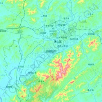
Nom : Carte topographique Jingdezhen, altitude, relief.
Altitude moyenne : 100 m
Altitude minimum : 14 m
Altitude maximum : 612 m