Géolocaliser

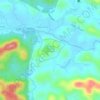
Carte topographique Ellumandam

Cliquez sur la carte pour afficher l’altitude.

À propos de cette carte

Nom : Carte topographique Ellumandam, altitude, relief.

Lieu : Ellumandam, Mananthavady, Wayanad, Kerala, 670645, India (11.76586 75.94229 11.80586 75.98229)

Altitude moyenne : 741 m

Altitude minimum : 716 m

Altitude maximum : 806 m

Autres cartes topographiques

Cliquez sur une carte pour visualiser sa topographie, son altitude et son relief.

Mazhuvannoor

India > Kerala > Mananthavady > Mazhuvannur

Altitude moyenne : 733 m

Gurukula Botanical Sanctuary

India > Kerala > Mananthavady > Periya

Altitude moyenne : 756 m

Kattikulam

India > Kerala > Mananthavady > Kattikkulam

Altitude moyenne : 772 m

Vellamunda

India > Kerala > Mananthavady > Peechamcode

Altitude moyenne : 812 m

Équipez-vous pour votre prochaine aventure :

📱Supports smartphone randonnée - Supports pratiques pour navigation mobile
🧭Kits de survie - Équipement essentiel en pleine nature
🔦Lanterne de camping LED - Éclairage d'ambiance pour l'intérieur de la tente
🎒Sac d'hydratation pour cyclisme - Compact pour les sorties rapides en VTT
🔥Allume-feu - Démarrage du feu en conditions difficiles

En tant que Partenaire Amazon, ce site perçoit une commission sur les achats éligibles sans surcoût pour vous.