
Carte topographique Wilmington
Carte interactive
Cliquez sur la carte pour afficher l’altitude.
À propos de cette carte
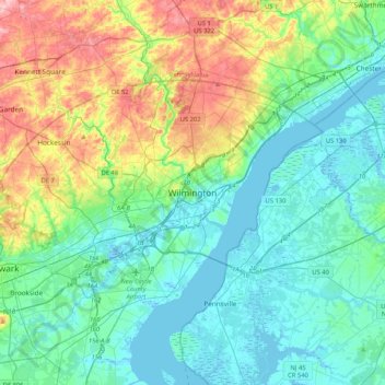
Nom : Carte topographique Wilmington, altitude, relief.
Altitude moyenne : 43 m
Altitude minimum : -5 m
Altitude maximum : 170 m
On the western side of Market Street, the Piedmont topography is rocky and hilly, rising to a point that marks the watershed between the Brandywine River and the Christina River. This watershed line runs along Delaware Avenue westward from 10th Street and Market Street.