
Carte topographique Piešťany
Carte interactive
Cliquez sur la carte pour afficher l’altitude.
Piešťany
Piešťany is situated in the western part of Slovakia, in the valley of the Váh river, at an elevation of 162 metres (531.50 feet). The Považský Inovec mountains form the eastern boundary of this part of the Váh valley. The highest hill of these mountains, Inovec 1,042 m (3,418.64 ft), is about 25 km (16 mi) north of the town. The hills immediately east of the town (10 km (6 mi) away) reach a height of about 700 m (2,296.59 ft). On the western side, the valley boundary is formed by the Little Carpathians, which are somewhat lower and further away from the town. The valley is open to the south, and thus has a warm and sunny temperate climate.
À propos de cette carte
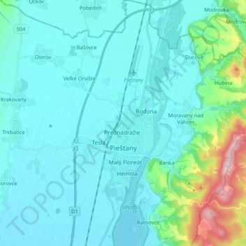
Nom : Carte topographique Piešťany, altitude, relief.
Altitude moyenne : 196 m
Altitude minimum : 152 m
Altitude maximum : 473 m