
Carte topographique Province of Tumbes
Carte interactive
Cliquez sur la carte pour afficher l’altitude.
À propos de cette carte
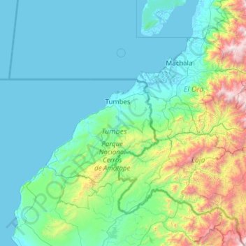
Nom : Carte topographique Province of Tumbes, altitude, relief.
Lieu : Province of Tumbes, Tumbes, Peru (-4.75000 -81.41667 -2.75000 -79.41667)
Altitude moyenne : 460 m
Altitude minimum : -2 m
Altitude maximum : 4 014 m
Autres cartes topographiques
Cliquez sur une carte pour visualiser sa topographie, son altitude et son relief.