
Carte topographique Bapchild
Carte interactive
Cliquez sur la carte pour afficher l’altitude.
À propos de cette carte
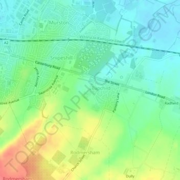
Nom : Carte topographique Bapchild, altitude, relief.
Lieu : Bapchild, Borough of Swale, Kent, England, United Kingdom (51.32533 0.75354 51.34061 0.77625)
Altitude moyenne : 21 m
Altitude minimum : -1 m
Altitude maximum : 60 m