
Carte topographique Paulínia
Carte interactive
Cliquez sur la carte pour afficher l’altitude.
À propos de cette carte
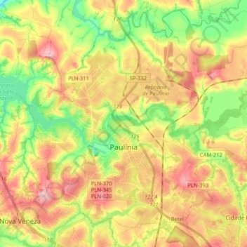
Nom : Carte topographique Paulínia, altitude, relief.
Altitude moyenne : 584 m
Altitude minimum : 510 m
Altitude maximum : 657 m
Paulínia is a municipality in the state of São Paulo in Brazil. It is part of the São Paulo Macrometropolis. The population is 112,003 (2020 est.) in an area of 138.78 km². The elevation is 590 m. It is known for hosting the Replan, the largest refinery of Petrobras.