
Carte topographique Karer See - Lago di Carezza
Carte interactive
Cliquez sur la carte pour afficher l’altitude.
À propos de cette carte
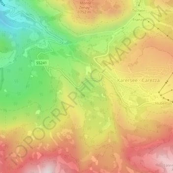
Nom : Carte topographique Karer See - Lago di Carezza, altitude, relief.
Altitude moyenne : 1 606 m
Altitude minimum : 1 223 m
Altitude maximum : 1 950 m
The lake is located in the western Dolomites on the edge of the Latemarwald, just 20 kilometers southeast of Bolzano at 1520 m altitude in the municipality Welschnofen. The nearest settlement is Carezza. The roughly 300 m long and 140 m wide stretch of water is fed by underground springs from the Latemar mountain range.