
Carte topographique Banff
Cliquez sur la carte pour afficher l’altitude.
Banff
Banff is a town within Banff National Park in Alberta, Canada. It is located in Alberta's Rockies along the Trans-Canada Highway, approximately 126 km (78 mi) west of Calgary and 58 km (36 mi) east of Lake Louise. At 1,400 to 1,630 m (4,590 to 5,350 ft) above sea level, Banff is the community with the second highest elevation in Alberta, after Lake Louise.
À propos de cette carte
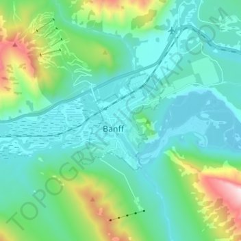
Nom : Carte topographique Banff, altitude, relief.
Lieu : Banff, Alberta, T1L 1A6, Canada (51.13778 -115.60825 51.21778 -115.52825)
Altitude moyenne : 1 615 m
Altitude minimum : 1 342 m
Altitude maximum : 2 745 m