
Carte topographique Lake Rukwa
Carte interactive
Cliquez sur la carte pour afficher l’altitude.
À propos de cette carte
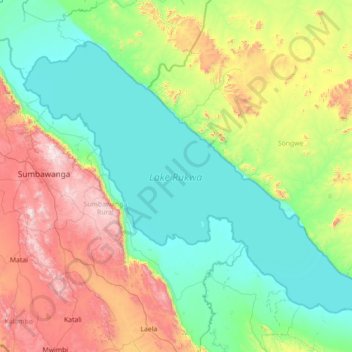
Nom : Carte topographique Lake Rukwa, altitude, relief.
Lieu : Lake Rukwa, Songwe Region, Southern Highlands Zone, Tanzania (-8.50863 31.53946 -7.42159 32.93349)
Altitude moyenne : 1 189 m
Altitude minimum : 790 m
Altitude maximum : 2 425 m
The alkaline Lake Rukwa lies midway between Lake Tanganyika and Lake Malawi at an elevation of about 800 metres (2,600 ft), in a parallel branch of the rift system. Almost half of the lake lies in Uwanda Game Reserve.