
Carte topographique Roermond
Carte interactive
Cliquez sur la carte pour afficher l’altitude.
À propos de cette carte
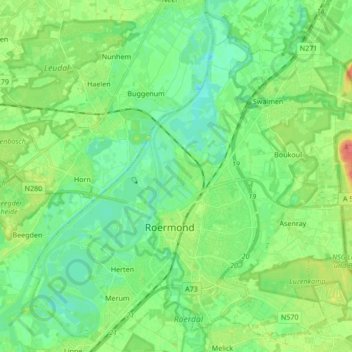
Nom : Carte topographique Roermond, altitude, relief.
Lieu : Roermond, Limburg, Nederland (51.15875 5.91665 51.25868 6.08602)
Altitude moyenne : 25 m
Altitude minimum : 9 m
Altitude maximum : 61 m
Autres cartes topographiques
Cliquez sur une carte pour visualiser sa topographie, son altitude et son relief.