
Carte topographique Otham
Cliquez sur la carte pour afficher l’altitude.
À propos de cette carte
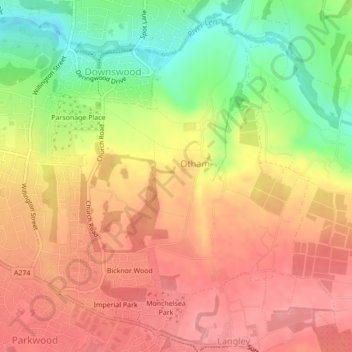
Nom : Carte topographique Otham, altitude, relief.
Lieu : Otham, Maidstone, Kent, England, United Kingdom (51.24034 0.55689 51.26433 0.58850)
Altitude moyenne : 76 m
Altitude minimum : 20 m
Altitude maximum : 112 m
Autres cartes topographiques
Cliquez sur une carte pour visualiser sa topographie, son altitude et son relief.
The Hernitage and High Noon Farm
United Kingdom > England > Kent > Maidstone > Detling
Altitude moyenne : 145 m