
Carte topographique Datong
Carte interactive
Cliquez sur la carte pour afficher l’altitude.
À propos de cette carte
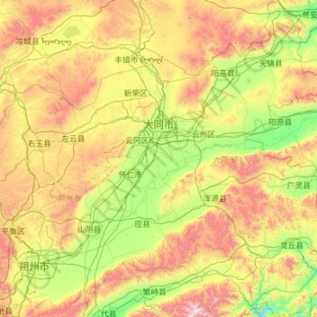
Nom : Carte topographique Datong, altitude, relief.
Lieu : Datong, Shanxi, China (39.04845 112.57067 40.74496 114.56551)
Altitude moyenne : 1 339 m
Altitude minimum : 690 m
Altitude maximum : 3 029 m
Autres cartes topographiques
Cliquez sur une carte pour visualiser sa topographie, son altitude et son relief.
Fangshan
China > Shanxi > Fangshan County > Fangshan
Fangshan, Fangshan County, Lüliang City, Shanxi, China
Altitude moyenne : 1 383 m