
Carte topographique Bedford
Carte interactive
Cliquez sur la carte pour afficher l’altitude.
À propos de cette carte
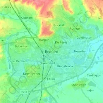
Nom : Carte topographique Bedford, altitude, relief.
Altitude moyenne : 37 m
Altitude minimum : 20 m
Altitude maximum : 83 m
As with the rest of the United Kingdom, Bedford has a maritime climate, with a limited range of temperatures, and generally even rainfall throughout the year. The nearest Met Office weather station to Bedford is Bedford (Thurleigh) airport, about 6.5 miles (10.5 km) north of Bedford town centre at an elevation of 85 metres (279 ft). Temperature extremes at the site have ranged from 37.5 °C (99.5 °F) in July 2019, down to −15.3 °C (4.5 °F) in January 1982. However, such extremes would likely be superseded if longer-term records were available – Historically, the nearest weather station to Bedford was Cardington about 2.4 miles (3.9 km) south south east of the town centre with an elevation of 30 metres (98 ft). This location recorded a minimum of −18.3 °C (−0.9 °F) during January 1963.