
Carte topographique Coromoro
Carte interactive
Cliquez sur la carte pour afficher l’altitude.
À propos de cette carte
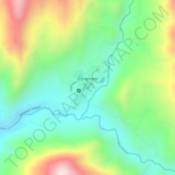
Nom : Carte topographique Coromoro, altitude, relief.
Lieu : Coromoro, Guanentá, Santander, Colombia (6.29079 -73.04354 6.29772 -73.03871)
Altitude moyenne : 1 623 m
Altitude minimum : 1 436 m
Altitude maximum : 1 925 m
Autres cartes topographiques
Cliquez sur une carte pour visualiser sa topographie, son altitude et son relief.