
Carte topographique Herval
Carte interactive
Cliquez sur la carte pour afficher l’altitude.
À propos de cette carte
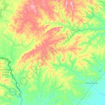
Nom : Carte topographique Herval, altitude, relief.
Altitude moyenne : 152 m
Altitude minimum : 8 m
Altitude maximum : 476 m
Herval is a Brazilian municipality in the southern part of the state of Rio Grande do Sul. The population is 6,975 (2015 est.) in an area of 1757.84 km². Its elevation is 287 m. Its main industry is agriculture.