
Carte topographique Diên Khánh
Carte interactive
Cliquez sur la carte pour afficher l’altitude.
À propos de cette carte
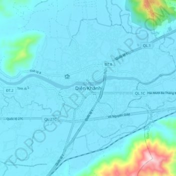
Nom : Carte topographique Diên Khánh, altitude, relief.
Lieu : Diên Khánh, Diên Khánh District, Khánh Hòa Province, Vietnam (12.21938 109.06080 12.29938 109.14080)
Altitude moyenne : 48 m
Altitude minimum : -1 m
Altitude maximum : 590 m
Autres cartes topographiques
Cliquez sur une carte pour visualiser sa topographie, son altitude et son relief.
Thôn Thượng
Vietnam > Khanh Hoa province > Diên Khánh District
Thôn Thượng, Diên Khánh District, Khánh Hòa Province, Vietnam
Altitude moyenne : 25 m