
Carte topographique Aalen
Carte interactive
Cliquez sur la carte pour afficher l’altitude.
À propos de cette carte
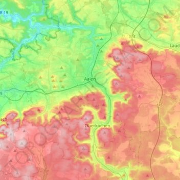
Nom : Carte topographique Aalen, altitude, relief.
Altitude moyenne : 554 m
Altitude minimum : 359 m
Altitude maximum : 771 m
The elevation in the centre of the market square is 430 metres (1,410 ft) relative to Normalhöhennull. The territory's lowest point is at the Lein river near Rodamsdörfle, the highest point is the Grünberg's peak near Unterkochen at 733 metres (2,405 ft).