
Carte topographique Plaster
Carte interactive
Cliquez sur la carte pour afficher l’altitude.
À propos de cette carte
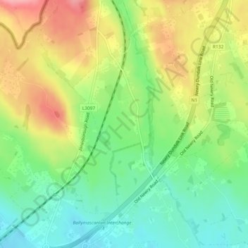
Nom : Carte topographique Plaster, altitude, relief.
Altitude moyenne : 55 m
Altitude minimum : 6 m
Altitude maximum : 121 m
Autres cartes topographiques
Cliquez sur une carte pour visualiser sa topographie, son altitude et son relief.
The Borough District of Drogheda
The Borough District of Drogheda, County Louth, Leinster, Irlanda
Altitude moyenne : 50 m