
Carte topographique Gaika’s Kop
Carte interactive
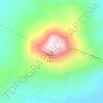
Cliquez sur la carte pour afficher l’altitude.
À propos de cette carte
Nom : Carte topographique Gaika’s Kop, altitude, relief.
Altitude moyenne : 1 583 m
Altitude minimum : 1 398 m
Altitude maximum : 1 961 m
Autres cartes topographiques
Cliquez sur une carte pour visualiser sa topographie, son altitude et son relief.
Fort Fordyce Nature Reserve
RSA > Eastern Cape > Nkonkobe Local Municipality
Fort Fordyce Nature Reserve, Nkonkobe Ward 8, Nkonkobe Local Municipality, Amathole District Municipality, Eastern Cape, RSA
Altitude moyenne : 963 m
Kat River
RSA > Eastern Cape > Nkonkobe Local Municipality
Kat River, Nkonkobe Local Municipality, Amathole District Municipality, Eastern Cape, RSA
Altitude moyenne : 362 m