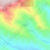
Carte topographique Hidden Valley Lake
Cliquez sur la carte pour afficher l’altitude.
À propos de cette carte

Nom : Carte topographique Hidden Valley Lake, altitude, relief.
Altitude moyenne : 395 m
Altitude minimum : 280 m
Altitude maximum : 690 m
Autres cartes topographiques
Cliquez sur une carte pour visualiser sa topographie, son altitude et son relief.
Spring Valley
United States > California > Lake County
Spring Valley is a census-designated place in Lake County, California. Spring Valley sits at an elevation of 1,581 feet (482 m). The 2010 United States census reported Spring Valley's population was 845.
Altitude moyenne : 488 m

Lucerne
United States > California > Lake County > Lucerne
Lucerne (formerly Clear Lake Beach, located in the area called Sikom by the Eastern Pomo) is a census-designated place (CDP) in Lake County, California, United States. Lucerne is located 7.25 miles (12 km) east-northeast of Lakeport, at an elevation of 1329 feet (405 m). The population was 235 in 1871, 2,870…
Altitude moyenne : 519 m
Upper Lake
United States > California > Lake County > Upper Lake
Upper Lake is a census-designated place (CDP) in Lake County, California, United States. Upper Lake is located 8 miles (13 km) north of Lakeport, at an elevation of 1,345 feet (410 m). The population was 1,052 at the 2010 census, up from 989 at the 2000 census. The Habematolel Pomo of Upper Lake are…
Altitude moyenne : 440 m

Lower Lake
United States > California > Lake County
Lower Lake is located 4.5 miles (7.2 km) southwest of the City of Clearlake, and 13 miles (21 km) southeast of Kelseyville. It is at an elevation of 1,371 feet (418 m). Lower Lake was at one point the county seat; the Lake County elections of 1867 were hotly contested, with the seat moving between what is now…
Altitude moyenne : 490 m

Clearlake
United States > California > Lake County > Clearlake > Clearlake
Clearlake is a city in Lake County, California. Clearlake is 4.5 miles (7.2 km) north-northwest of Lower Lake, at an elevation of 1,417 feet (432 m). As of the 2020 census, the city had a total population of 16,685, up from 15,250 in 2010. It takes its name from Clear Lake.
Altitude moyenne : 467 m