Géolocaliser

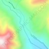
Carte topographique Songhangra

Cliquez sur la carte pour afficher l’altitude.

À propos de cette carte

Nom : Carte topographique Songhangra, altitude, relief.

Lieu : Songhangra, Joshimath Tehsil, Chamoli, Uttarakhand, 246443, India (30.54493 79.65958 30.54503 79.65968)

Altitude moyenne : 4 240 m

Altitude minimum : 3 553 m

Altitude maximum : 4 799 m

Autres cartes topographiques

Cliquez sur une carte pour visualiser sa topographie, son altitude et son relief.
Hemkund

India > Uttarakhand > Joshimath Tehsil

Altitude moyenne : 4 367 m

Mana

India > Uttarakhand > Joshimath Tehsil

Altitude moyenne : 4 959 m

Saraswati

India > Uttarakhand > Joshimath Tehsil > Mana

Altitude moyenne : 5 393 m

Nanda Ghunti Glacier

India > Uttarakhand > Joshimath Tehsil

Altitude moyenne : 5 086 m

Équipez-vous pour votre prochaine aventure :

🧺Serviette microfibre séchage rapide - Légère et compacte pour l'hygiène en randonnée
🧥Doudoune compressible - Chaleur instantanée pour les pauses au sommet
🧗Équipement alpinisme - Matériel pour terrains exigeants
🔦Lampes frontales - Éclairage mains libres pour randonnée et camping
🚲Support smartphone pour vélo - Utilisez topographic-map.com en direct sur votre guidon

En tant que Partenaire Amazon, ce site perçoit une commission sur les achats éligibles sans surcoût pour vous.