
Carte topographique Nirmal
Carte interactive
Cliquez sur la carte pour afficher l’altitude.
À propos de cette carte
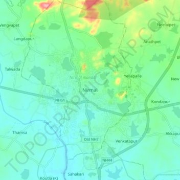
Nom : Carte topographique Nirmal, altitude, relief.
Altitude moyenne : 335 m
Altitude minimum : 310 m
Altitude maximum : 424 m
Nirmal is located at 19°06′N 78°21′E / 19.10°N 78.35°E / 19.10; 78.35. It has an average elevation of 340 metres (1100 feet) on the foot hills of Nirmal range, which is located in the Deccan plateau.Nirmal has chain tanks built around it.