
Carte topographique Williston
Carte interactive
Cliquez sur la carte pour afficher l’altitude.
À propos de cette carte
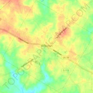
Nom : Carte topographique Williston, altitude, relief.
Altitude moyenne : 101 m
Altitude minimum : 77 m
Altitude maximum : 121 m
Autres cartes topographiques
Cliquez sur une carte pour visualiser sa topographie, son altitude et son relief.
Blackville
United States > South Carolina > Barnwell County
Blackville, Barnwell County, South Carolina, 29817, United States
Altitude moyenne : 85 m
Barnwell
United States > South Carolina > Barnwell County > Barnwell
Barnwell, Barnwell County, South Carolina, 29812, United States
Altitude moyenne : 65 m
Hilda
United States > South Carolina > Barnwell County > Hilda
Hilda, Barnwell County, South Carolina, 29813, United States
Altitude moyenne : 78 m