
Carte topographique Harlington Corner
Carte interactive
Cliquez sur la carte pour afficher l’altitude.
À propos de cette carte
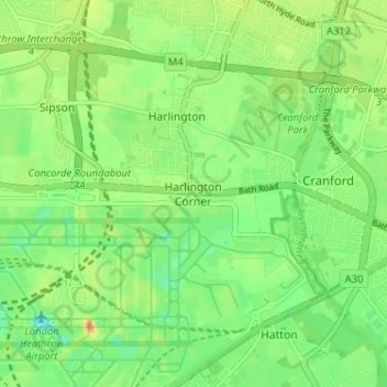
Nom : Carte topographique Harlington Corner, altitude, relief.
Altitude moyenne : 26 m
Altitude minimum : 1 m
Altitude maximum : 64 m
Autres cartes topographiques
Cliquez sur une carte pour visualiser sa topographie, son altitude et son relief.
Harefield
United Kingdom > England > London Borough of Hillingdon
Harefield, London Borough of Hillingdon, Greater London, England, UB9 6BD, United Kingdom
Altitude moyenne : 66 m