
Carte topographique Villa Ashaninka
Carte interactive
Cliquez sur la carte pour afficher l’altitude.
À propos de cette carte
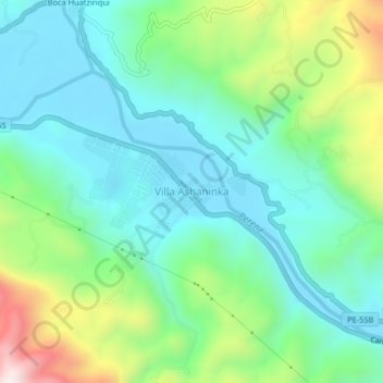
Nom : Carte topographique Villa Ashaninka, altitude, relief.
Lieu : Villa Ashaninka, Pichanaqui, Chanchamayo, Junín, Perú (-10.98516 -74.81632 -10.94516 -74.77632)
Altitude moyenne : 649 m
Altitude minimum : 470 m
Altitude maximum : 1 126 m