
Carte topographique Jutogh
Cliquez sur la carte pour afficher l’altitude.
Jutogh
Jutogh is located at 31°06′N 77°07′E / 31.1°N 77.12°E / 31.1; 77.12 near Totu, an important suburb of Shimla city. It has an average elevation of 1729 metres (5673 feet), a total green area of 112.62 Acres, and a public garden known as Cantt. Board Public Garden.
À propos de cette carte
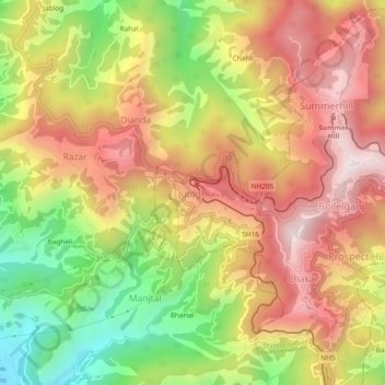
Nom : Carte topographique Jutogh, altitude, relief.
Lieu : Jutogh, Chakar, Shimla, Himachal Pradesh, 171005, India (31.08065 77.10193 31.12065 77.14193)
Altitude moyenne : 1 785 m
Altitude minimum : 1 349 m
Altitude maximum : 2 150 m