
Carte topographique Honey Hill
Carte interactive
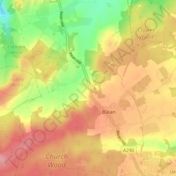
Cliquez sur la carte pour afficher l’altitude.
À propos de cette carte
Nom : Carte topographique Honey Hill, altitude, relief.
Altitude moyenne : 61 m
Altitude minimum : 5 m
Altitude maximum : 101 m
Autres cartes topographiques
Cliquez sur une carte pour visualiser sa topographie, son altitude et son relief.
Clowes Wood
United Kingdom > England > Kent > Canterbury > Blean
Clowes Wood, Blean, Canterbury, Kent, England, United Kingdom
Altitude moyenne : 53 m