
Carte topographique Sandway
Carte interactive
Cliquez sur la carte pour afficher l’altitude.
À propos de cette carte
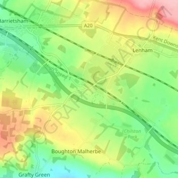
Nom : Carte topographique Sandway, altitude, relief.
Altitude moyenne : 113 m
Altitude minimum : 55 m
Altitude maximum : 192 m
Autres cartes topographiques
Cliquez sur une carte pour visualiser sa topographie, son altitude et son relief.
Leadingcross Green
United Kingdom > England > Kent > Maidstone > Lenham
Leadingcross Green, Lenham, Maidstone, Kent, England, ME17 2HS, United Kingdom
Altitude moyenne : 118 m